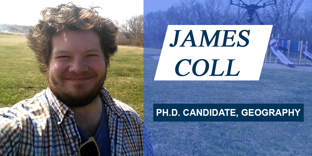
Water is all around us, and there’s a lot of it. More than 2.7 million miles of streams and rivers exist in the U.S. alone, in fact. We’re surrounded by H20 in America, and yet there are still large gaps in our understanding of the state and trends of the water cycle, which can have seriously devastating ramifications. James Coll wants to fill that data void, and his research in KU Geography’s Ph.D. program centers on ways that drone technology can help scholars measure and categorize that cycle. “If my research succeeds, I like to say that I’ll be able to tell you if your house will be underwater tomorrow.”
Meet James, learn about how his research in geography allows him to apply environmental science and policy to answer questions with tangible consequences, and see what advice he has for KU students about choosing the right area of study.
Hometown: Andover, New Hampshire
Tell us what your PhD thesis is on in under 200 characters, make it Twitter-friendly:
With more than 2.7 million miles of streams and rivers in the US, traditional means of measuring them are unscalable. I think drones have a large role to play in addressing this data void.
You received several research awards in the spring 2018 semester for three different projects. What is the main focus of your work – what drives your research?
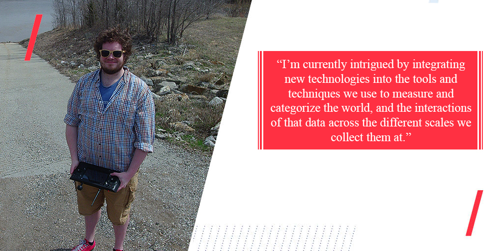
I did. Like all bad grad students, I’m too scattered. The theme which underlines my research, broadly, is quantifying the state and trends of the water cycle. As with many academic pursuits, although we have a solid understanding of the water cycle once you drill down into the specifics there are a number of uncertainties that dominate the research landscape. I also really enjoy being outdoors, so any reason to get me outside and into the environment is a huge draw. I’m currently intrigued by integrating new technologies into the tools and techniques we use to measure and categorize the world, and the interactions of that data across the different scales we collect them at. Finally, whatever discovery I make needs to be communicated in a more intelligent manner than the broad stroke, impersonal approach currently being used, so exploring the potential ways in which we can communicate this science through a technological lens (as opposed to a societal lens) also plays a large role in my research.
Can you tell us a little more about your research?
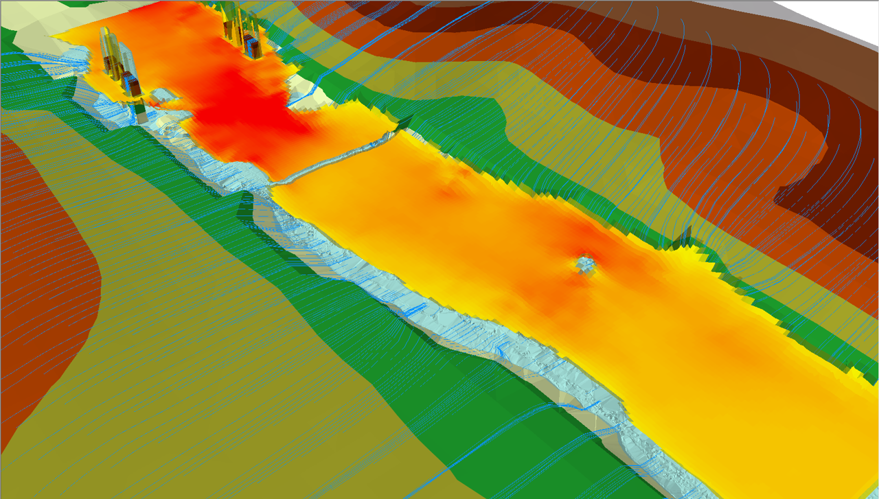
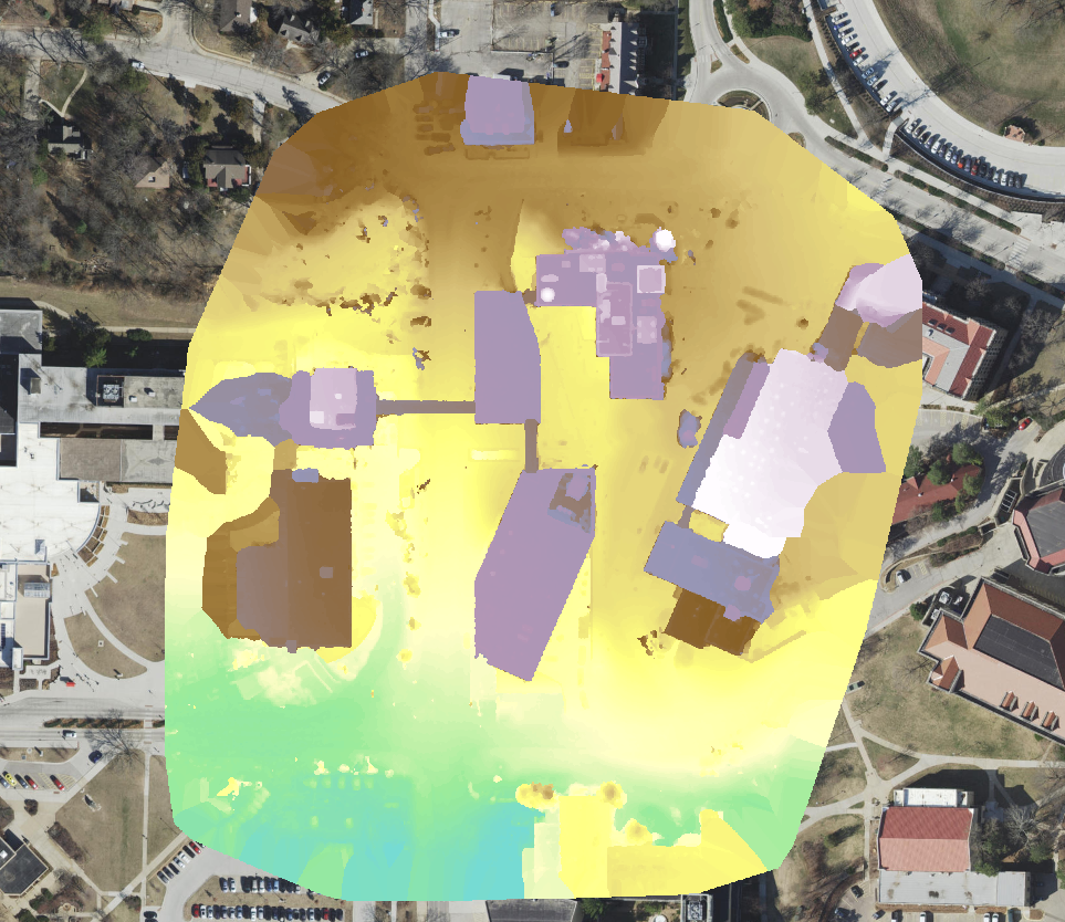
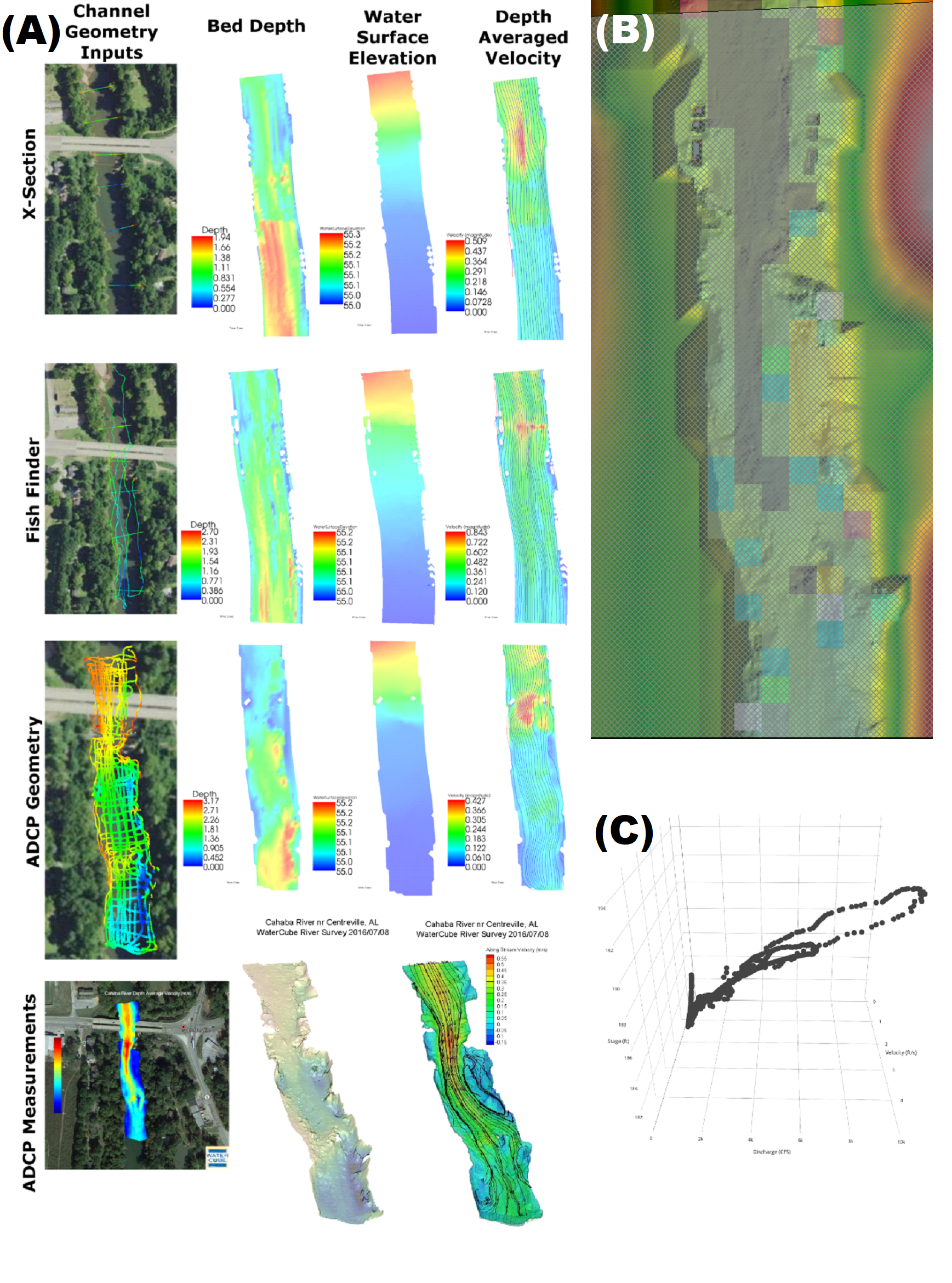
If my research succeeds, I like to say that I’ll be able to tell you if your house will be underwater tomorrow. To follow through with this rather audacious claim, we need to be able to do a few things: forecast how much water will be in the river and determine where that water will go. This means we need to know what level of terrain detail is needed to accurately model the flood, and how to go about collecting that level of detail in a timely manner. To do this, I use a combination of state flown lidar, augment that with my own data collected with a drone, and the shape of the river bed which can be collected with fancy instruments called Acoustic Doppler Current Profilers (ADCP). That data goes into geographic information software where we process it and then into hydraulic models where we model the flood extent and then compare that with observations. Although these measurements have traditionally been made in in transects, falling computational barriers means extending these into 3 dimensions is easier than ever. By researching these techniques, we can more completely understand the theories of fluid dynamics, which has practical implications in hydraulic design and flood management. This entire process, from measurement to communication, is where my research interests lie.
Where are you conducting your research? In archives? In laboratories? What are your sources?
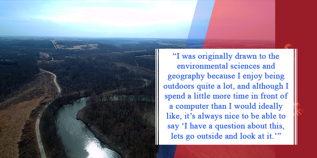
My research is a blend of field collection methods and modeling/analysis and development. I was originally drawn to the environmental sciences and geography because I enjoy being outdoors quite a lot, and although I spend a little more time in front of a computer than I would ideally like, it’s always nice to be able to say “I have a question about this, lets go outside and look at it.” So as long as the water is deep enough to stand in, I can perform my research.
What is one thing you think everyone should know about your research project or research interests? This might be a commonly held belief that your research questions or complicates.
That our ability to predict rivers are no longer limited to just areas with USGS gages, and the tools we use to measure, predict, and communicate their state is now significantly easier to use than even 5 years ago. That and that drones can be serious scientific instruments and not just toys for fun.
What is the most valuable experience you have had while studying at KU?
Related to graduate school in general, the most valuable experience would have to be the opportunity to further specialize in what I want to do.
Was there a moment when you decided this is what you wanted to study? What was that journey like? What was the process of refining them?
If I had to pick a defining moment when I had that “a ha” moment, it would have to be when I was spending the summer with CUAHSI (Consortium of Universities for the Advancement of Hydrologic Sciences). After spending most of the summer trying to measure a small section of river, John Sloat from WaterCube came out one afternoon and hopped in the water with his ADCP and within 3 hours had one of the most gorgeous bathymetric models I had ever seen, and I knew that this was a skill I needed to pick up and study. From that point on, it was a long hard slog to refine, frame, and phrase my desire into a passably coherent research idea.
What advice would you give other students applying for research funding opportunities?
Don’t be discouraged when you don’t get them, and apply to a lot of opportunities. I like to emphasize the more tangible aspects of the outcomes (papers, programs, code, ect.), and the benefits that funding that research has to the organization.
Give a shout-out to a professor, mentor, advisor, or someone at KU who has helped you?
I would not be where I am today without my advisor, Xingong Li in the Geography and Atmospheric Science department, who took me on for my Masters and kept me around for the PhD, and introduced me not only to the world of academia, but also a host of larger academic institutions like UCGIS and CUAHSI, where I meet several of the people who were authors on papers I was reading, and graduate students from across the country.
What about the future of the field of geography excites you most?
It may be a biased perspective, but I really do think the geographic field has the tools we need to address and resolve a great many of the issues we face as we look towards the future. Despite, or perhaps because, geography is such a broad discipline, it has the potential to readily absorb the latest and greatest advances in other fields and use them to tackle issues they would otherwise not be applied to for many more years. As an example, although drones and drone research has traditionally resided within the realm of aerospace engineering, geography has taken it and applied that for use in archeological mapping, remote sensing applications, and photogrammetric techniques. Fun fact: geography is the only department in KU that has a class which requires you to fly a drone to pass, drone mapping.
What do you plan to do after you graduate from KU / What are your career plans?
Can we make it through the week? Haha. At this point I’ve come a little too far into academia to not consider being a professor and the idea of directing my own research agenda is certainly appealing. However, my research has enabled me to pick up some fantastic skills that translate well into the private sector and I’ve met some outstanding individuals at NOAA, the National Weather Service, and the Army Corp of Engineers. So, I guess we’ll see.
What led you to Geography and why did you choose the University of Kansas?
(Besides funding!) Geography sits at that sweet spot between theory and practice, where I can bring my environmental science and policy skills together with technology and application to ask and answer the questions that I am interested in and have practical and tangible consequences. Geographers also have the most fun. I landed at the University of Kansas because they provided the best funded opportunity and were incredibly supportive of my sometimes very disparate research questions.
If you had advice for freshmen or others investigating majors, why do you think they should explore geography?
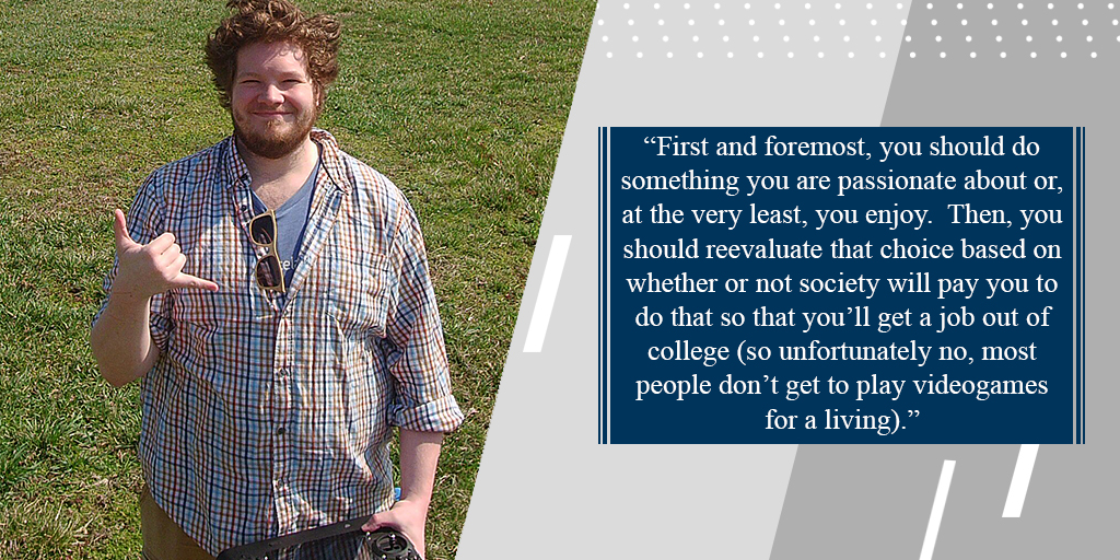
First and foremost, you should do something you are passionate about or, at the very least, you enjoy. Then, you should reevaluate that choice based on whether or not society will pay you to do that so that you’ll get a job out of college (so unfortunately no, most people don’t get to play videogames for a living). That being said, you’ll be hard pressed to not find some aspect of those in the Geography and Atmospheric Science department. Like computers and data science? Geographic information science and atmospheric modeling sits at the bleeding edge of big data and computational complexity and some of the slickest applications are geographically driven (think Google maps or Pokémon go). Like policy or the more social aspects? Geography is the primary tool used in qualifying and quantifying social injustice issues. Finally, regardless of what aspect you’re interested in, geography and atmospheric science majors are some of the happiest and most inclusive group of folks you’ll ever know, and there’s never a dull moment around them. In short: Geography (and atmospheric science) is where it’s at.
What motivates you?
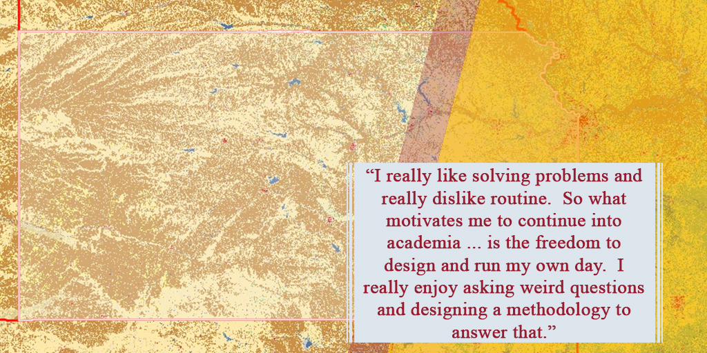
I really like solving problems and really dislike routine. So what motivates me to continue into academia (aside from the thought of having to get a 9-5 job where pants are required) is the freedom to design and run my own day. I really enjoy asking weird questions and designing a methodology to answer that.
What motivates you?You were president of the GIS Day at KU committee and led the event. Why is GIS Day and GIS technology important? Will there be new things people can expect at the 2018 GIS Day this fall?
GIS day is a worldwide event held every year in celebration of and to raise awareness of the wonders of geographic information science. The committee consists of students from several departments, Libraries, and the Institute for Policy & Social Research, and we take over the 4th floor of the union all day and host invited speakers, a job/information fair, activities and a student poster competition. This free event brings together students, faculty, and the greater public to see how GIS is making a positive change in the world. Last year was the first time we had a high school class attend with fantastic results, so this year we expect to see a lot more participation from that demographic. We also hope to have the state emergency GIS van and a drone exhibit to make an appearance. Stay tuned for more information and look for announcements at gis.ku.edu
Be like James. Discover a field that your passionate about that you can make a realistic difference in. For more information about KU’s Geography program, visit their web page and learn more about the opportunities they offer. Additionally, be sure to check out the GIS website for more information regarding GIS day at KU.